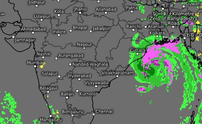
Bhubaneswar: The well marked low pressure area (LOPAR) formed over the south-east Bay of Bengal and its neighborhood is likely to intensify gradually into a depression by Friday evening and then develop into a cyclonic storm within the next 24 hours, the Centre for Environment and Climate (CEC), SOA Deemed to be University, here said on Friday.
The system is likely to take the shape of a deep depression by Saturday morning and intensify into a cyclonic storm by evening, Dr. Sarat Chandra Sahu, Director of CEC, said.
Preliminary analysis showed that it might move in a northwestwardly
direction till Sunday after which its intensification would be vigorous with
the system changing direction and moving north-northeastward. It could
intensify gradually into a very severe cyclonic storm by May19 evening, he
said.
Dr. Sahu said model products indicated that the system would move in the bay along the Tamil Nadu-Andhra Pradesh-Odisha coast from May 17 to 19 and would come close to the Odisha-West Bengal coast from May 19 night and cross the coast somewhere along north Odisha-West Bengal or West Bengal in the evening of May 20.
The system is likely to impact the
coastal Odisha districts of Puri, Kendrapara, Jagatsinghpur, Bhadrak and Balesore.

